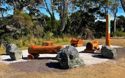
This project aims to showcase the unique beauty of the Robbins Passage – Boullanger Bay tidal wetlands while highlighting the immense ecological, economic and social value of this place for the Circular Head community and further afield.
The project builds on years of on-ground work, investment and community engagement aimed at protecting the natural values of Robbins Passage – Boullanger Bay through upstream water quality management, native vegetation protection and enhancement and Rice Grass control.
Robbins Passage – Boullanger Bay coastal wetlands are identified as a priority asset in the Cradle Coast NRM Strategy 2030. The ‘Celebrating Circular Head’s Coastal Wetlands’ video aims to address Action WW2.c in the Strategy:
Build on current community and industry education to increase awareness of the areas’s natural and cultural values, the ecological character of Robbins Passage – Boullanger Bay and associated threats.
Overview:
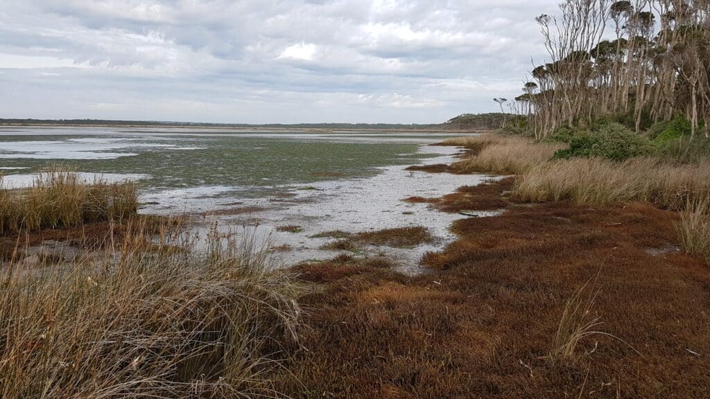
Stretching from Woolnorth Point to the Stanley peninsula, the Robbins Passage – Boullanger Bay tidal wetlands are the largest coastal wetlands in Tasmania, covering some 28,000 hectares. These wetlands provide immense natural and cultural values to the Circular Head community and further afield.
Natural and cultural values of Robbins Passage – Boullanger Bay
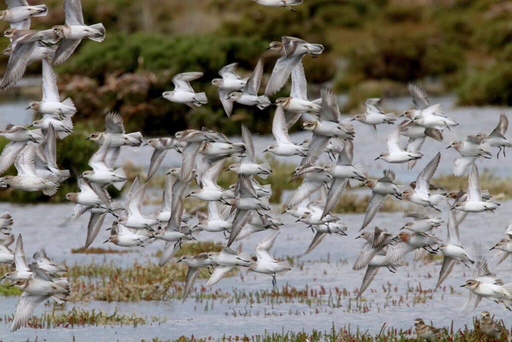
Every summer thousands of migratory shorebirds, born in Siberia or the Arctic tundra, fly to their Tasmanian home on the rich tidal wetlands of Circular Head.
The Robbins Passage – Boullanger Bay wetland complex features expansive and spectacular sandflats with wild, fierce currents generated as each tide rushes in, and thousands of busy birds feeding when the tide is out. The area hosts some of the furthest-travelling large flocks of migratory birds in the world, breeding in the Northern Hemisphere and travelling south to Tasmania annually to feed.
During migration, waterbirds rely on a system of highly productive wetlands to rest and feed, building up sufficient energy to fuel the next phase of their journey. Robbins Passage – Boullanger Bay is at the southern end of the East Asian-Australasian Flyway. The East Asian – Australasian Flyway stretches from the Russian Far East and Alaska, southwards through East Asia and South-east Asia, to Australia and New Zealand and encompasses 22 countries.
The shorebirds include several critically endangered species. They feed restlessly on the sea life in the sand flats and seagrass beds. And they shift with tide and wind, travelling from site-to-site to reach favoured feeding grounds or flocking in to rest on shore.
Fringing the coasts are two special ecological communities – saltmarsh, and paperbark swamp forests. These areas buffer the agricultural land of the north-west coast from winds and tides, protecting a high-value industry. The saltmarshes are the nurseries for millions of baby fish, the foundation of the healthy coastal food-webs we depend on.
The intertidal flats of Robbins Passage – Boullanger Bay provide oyster farming and fishing opportunities, as well as much-loved places for recreation, education and communing with nature. These sandy expanses contribute to the region’s growing ecotourism industry while supporting local culture and ways of life.
It’s not difficult to envision the significance of an area such as Robbins Island – Boullanger Bay to the Aboriginal community, especially to the occupying clans prior to European settlement. For millennia this area had played host to one of the largest seasonal gatherings of nations and clans recorded in Tasmania, drawing clans as far off as Big River Country in the Upper Ouse Valley, and Port Davey in the South West. Only an area of immense ecological value and resource could have hosted and sustained such gatherings.
The flowering of the Blackwoods would signify to each clan that it was time to get moving. After wintering inland, clans would travel coastward, collecting the swan and duck eggs from river estuaries, before making the journey to Cape Grim to congregate. This time of the year coincided with the returning of muttonbirds to their rookeries, and seals hauling out to mate. Both highly prized resources for their meat and fat content, crucial to surviving the next winter. Many offshore islands were exploited for these resources and travelled to by catamarans, such as the nearby Hunter Group. Sea birds and marsupial game were also in abundance, along with shellfish such as abalone, periwinkles, and whelks.
Fine red ochres from the Northern Nation’s mines in the Gog Ranges and Mt Housetop areas would have been an especially prized commodity, alongside the maireener shells collected from the seagrass beds around Robbins Island – Boullanger Bay. Gifts such as these would have been crucial in gaining permission to cross into the territories of other nations. However, the real prize for the younger clan members would be the opportunity to mingle amongst other nations and find marriage partners outside of their own family or clan group, further strengthening relations and diversifying bloodlines.
The Robbins Passage – Boullanger Bay wetland complex is listed on the Australian Directory of Important Wetlands. Wetlands in other places are also listed internationally, on the Ramsar list. A Ramsar listing conveys the global significance of a site, and we think that Robbins Passage – Boullanger Bay is worthy of this recognition.
Studies show that the Robbins Passage – Boullanger Bay wetland meets at least 6 criteria for Ramsar listing, which would maintain local industry, unlock funding to improve water quality, and recognise the special nature of Tasmania’s wildest coastal wetland.
Local threats that can be addressed by NRM actions:
- Land use pressures including development and intensification of industries.
- Land management practice in the catchment leading to chemical, nutrient and sediment runoff, into the wetland.
- Weed and pests.
- Aquaculture and fisheries management
Ramsar listing:
Cradle Coast Natural Resource Management (CCNRM) and Circular Head Council have written to the Tasmanian Minister for the Environment, requesting that the Minister initiates the Ramsar nomination process for this wetland. This will enable a detailed nomination to be prepared and submitted to the Australian Government to be considered for Ramsar listing
A number of other organisations, including Birdlife Tasmania and Circular Head Landcare Group, and scientists from the University of Tasmania support this nomination.
If nomination goes ahead, scientists, natural resource managers and interested community members will collaborate to complete ecological and social studies and develop the required documentation. This process could take a year or more. Residents will have opportunities to learn more and raise any concerns they might have.
Cradle Coast NRM are pursuing the Ramsar nomination to celebrate and raise awareness of the natural values around us and support increased investment in the maintenance and improvement of this asset. The Ramsar nomination can co-exist with wind-farm developments and other industries that bring socio-economic benefits to the area.
Funding provider: Cradle Coast Authority
Duration: Ongoing
Contact: Bonnie Bonneville, A/NRM Business Manager, 03 6433 8444, [email protected]
